NinskaPrints
Shop
About
Cart (
0
)
0
NinskaPrints
Shop
About
Contact us
All items
Astronomy, Meteorology
Fruit, Flowers, Plants
Landscapes, Architecture
Anthropology, Geology
Mammals & Marsupials
Fish & Reptiles
Birds & Eggs
Insects, Entomology
Military, Navy, Flags
World Maps, Oceans
Maps - UK, Ireland
Maps - UK Counties
Maps - Americas
Maps - US States, Cities
Maps - Europe, Africa
Maps - Asia, Australasia
Science, Technology
Fashion, Fine Art, Food
Children, Humour, Misc
Local History
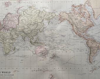
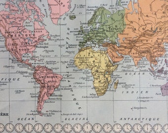
1882 The World on Mercator's Projection showing Ocean Currents and Navigation Tracks Large Original Antique Map - Pastel Colour Map
$49.18
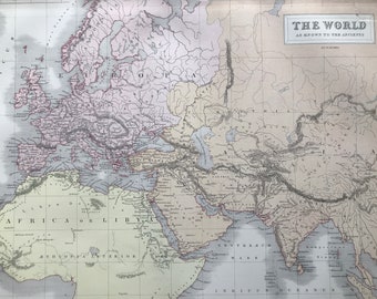
1876 The World as known to the Ancients Large Original Antique A & C Black Map - Classics - Ancient History
$51.99
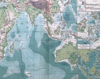
1903 Indian Ocean - Cables and Ocean Depths Large Original Antique Map with inset maps of the Malay Archipelago - Sargossa Sea
$42.15
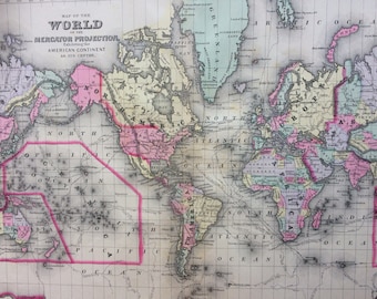
1888 WORLD on MERCATOR'S PROJECTION large rare original antique Mitchell Map - Antique World Map - Wall Decor - Home Decor - Gift Idea
$81.50
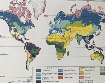
1940s Distribution of the World's Forested Regions Original Vintage Map - Mounted and Matted - World Map - Available Framed
$37.94
1897 Coal Distribution Original Antique World Map with inset maps of the United States and Western Europe - Available Framed
$35.13
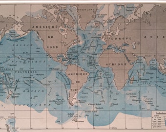
1923 Ocean Depths Original Antique World Map - Mounted and Matted - Vintage Wall Decor - Oceanography - Available Framed
$37.94
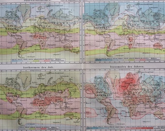
1896 Temperature Original Antique World Map - Isothermal Lines - Meteorology - Available Framed
$35.13
1897 Map of the History of Geography Original Antique Map - Available Framed - Cartography - Vintage Map
$35.13
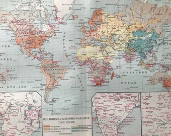
1896 Religions and Missions Original Antique World Map with inset maps of Southern Africa, India and China - Available Framed
$35.13
1923 Original Antique World Map - Mounted and Matted - Decorative Art - Wall Decor - Cartography - Globe - Available Framed
$40.75
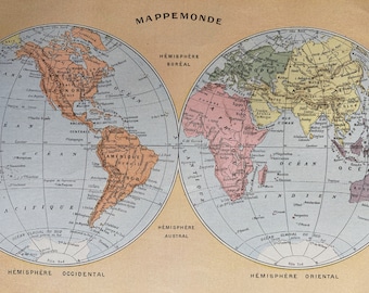
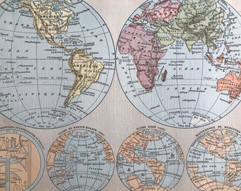
1923 World in Hemispheres Original Antique Map - Mounted and Matted - Available Framed
$54.80
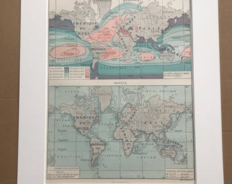
1897 Sea Water Salinity and Tides Original Antique Map - Meteorology - Oceanography - Mounted and Matted - Available Framed
$44.96
1897 Map of the History of Geography Original Antique Map - Available Framed - Cartography - Vintage Map
$35.13
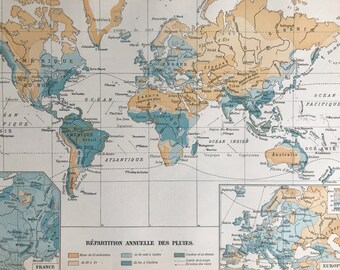
1897 Annual Distribution of Rain Original Antique Map - Meteorology - World Map - Mounted and Matted - Available Framed
$44.96
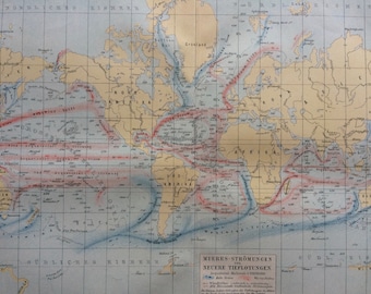
1897 Ocean Currents Original Antique World Map - Available Framed - Oceanography - Cartography - Vintage Map
$35.13
1897 Original Antique World Map - World in Hemispheres - World Maps from different eras - Mounted and Matted - Available Framed
$44.96
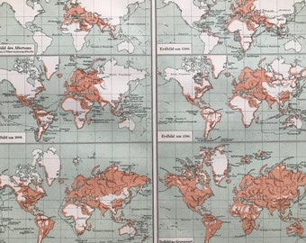
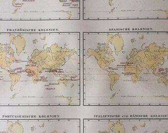
1896 Colonial Territories Original Antique World Map - British, Dutch, French, Spanish, Portuguese, Italian Available Framed
$35.13
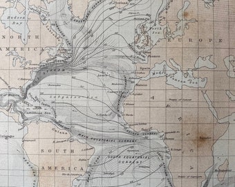
1875 Atlantic Ocean Original Antique Map showing Isothermal Lines and Currents - Oceanography - Available Matted and Framed
$34.43
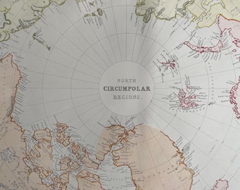
1882 North Circumpolar Regions Original Antique Map, 11 x 15 inches, Home Decor, Cartography, North Pole, Polar Regions, Arctic
$49.18
1
2
0 items in your cart
Close
Keep shopping! :)
Legal imprint
Close