NinskaPrints
Shop
About
Cart (
0
)
0
NinskaPrints
Shop
About
Contact us
All items
Astronomy, Meteorology
Fruit, Flowers, Plants
Landscapes, Architecture
Anthropology, Geology
Mammals & Marsupials
Fish & Reptiles
Birds & Eggs
Insects, Entomology
Military, Navy, Flags
World Maps, Oceans
Maps - UK, Ireland
Maps - UK Counties
Maps - Americas
Maps - US States, Cities
Maps - Europe, Africa
Maps - Asia, Australasia
Science, Technology
Fashion, Fine Art, Food
Children, Humour, Misc
Local History
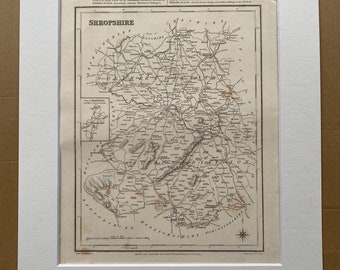
1845 Shropshire Original Antique Engraved Map - UK County Map - Available Framed - England
$63.55
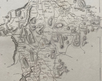
1845 Westmorland Original Antique Engraved Map - UK County Map - Available Framed - England
$63.55
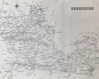
1845 Berkshire Original Antique Engraved Map - UK County Map - Available Framed - England
$63.55
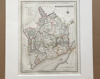
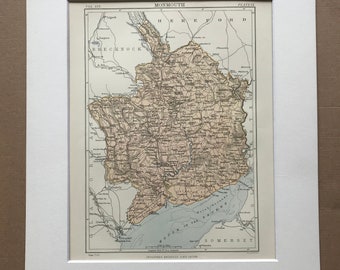
1845 Monmouthshire Original Antique Hand-Coloured Engraved Map - UK County Map - Available Framed - England
$63.55
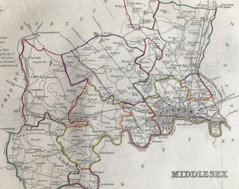
1845 Middlesex Original Antique Hand-Coloured Engraved Map - UK County Map - Decorative Art - Cartography - Wall Decor - England
$63.55
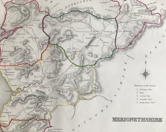
1845 Merionethshire Original Antique Hand-Coloured Engraved Map - UK County Map - Decorative Art - Cartography - Wall Decor - Wales
$63.55
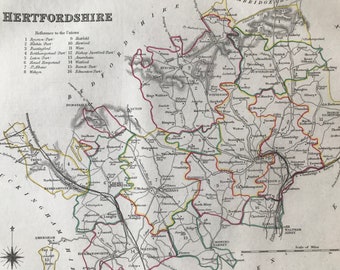
1845 Hertfordshire Original Antique Hand-Coloured Engraved Map - UK County Map - Available Framed - Cartography - Wall Decor - England
$63.55
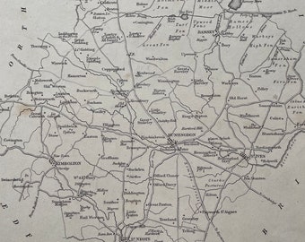
1845 Huntingdonshire Original Antique Engraved Map - UK County Map - Available Framed - England
$63.55
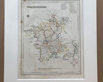
1845 Worcestershire Original Antique Hand-Coloured Engraved Map - UK County Map - Decorative Art - Cartography - Available Framed - England
$63.55
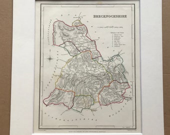
1845 Brecknockshire Original Antique Hand-Coloured Engraved Map - UK County Map - Available Framed - Wales
$63.55
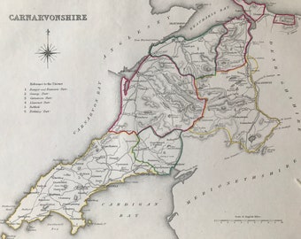
1845 Carnavonshire Original Antique Hand-Coloured Engraved Map - UK County Map - Available Framed - Wales
$63.55
1845 Northamptonshire Original Antique Engraved Map - UK County Map - Available Framed - England
$63.55
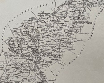
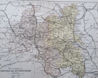
1882 Oxfordshire and Buckinghamshire Original Antique Map - Mounted and Matted - County Map - Available Framed - Cartography
$31.77
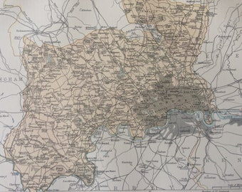
1875 Middlesex Original Antique Map - UK County - England - London - Vintage Wall Decor - Available Framed
$26.83
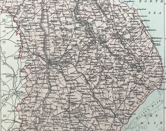
1875 Lincolnshire Original Antique Map - UK County Map - England - Vintage Wall Decor - Available Framed
$26.83
1875 Monmouthshire Original Antique Map - Warwick - UK County - England - Vintage Wall Map - Available Framed
$26.83
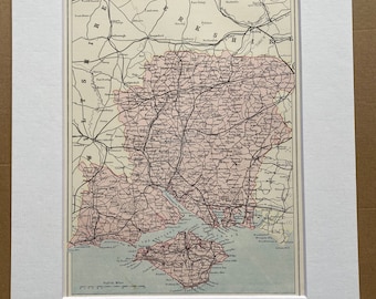
1875 Hampshire Original Antique Map - UK County - England - Available Matted and Framed
$36.72
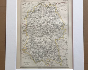
1875 Wiltshire Original Antique Map - English County Map - Unique Gift Idea - Available Framed - England - Wall Map
$26.83
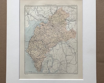
1875 Cumberland Original Antique Map - Warwick - UK County - England - Vintage Wall Map - Available Framed
$26.83
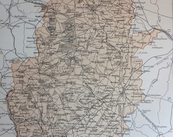
1875 Nottinghamshire Original Antique Map - England - UK County - Vintage Wall Map - Nottingham - Available Framed
$26.83
1
2
3
4
0 items in your cart
Close
Keep shopping! :)
Legal imprint
Close