NinskaPrints
Shop
About
Cart (
0
)
0
NinskaPrints
Shop
About
Contact us
All items
Astronomy, Meteorology
Fruit, Flowers, Plants
Landscapes, Architecture
Anthropology, Geology
Mammals & Marsupials
Fish & Reptiles
Birds & Eggs
Insects, Entomology
Military, Navy, Flags
World Maps, Oceans
Maps - UK, Ireland
Maps - UK Counties
Maps - Americas
Maps - US States, Cities
Maps - Europe, Africa
Maps - Asia, Australasia
Science, Technology
Fashion, Fine Art, Food
Children, Humour, Misc
Local History
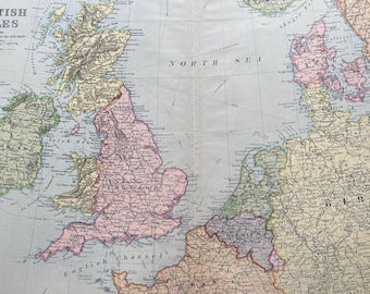
1902 British Isles showing Connections with the Continent Original Antique Map - Large Wall Map - England
$40.74
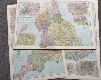
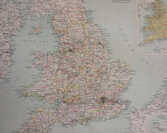
1902 England and Wales Set of 3 Large Original Antique Maps with inset maps of with Major Cities and Scilly Isles
$80.07
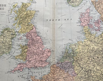
1896 British Isles and Northern Europe Original Antique map - Large Wall map - France, Belgium, Holland, Germany, Denmark, Sweden, Ireland
$33.71
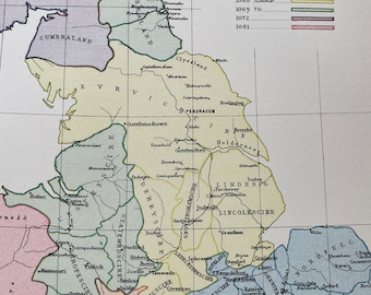
1875 England according to Domesday showing the progress of William's Conquests Original Antique Map
$35.12
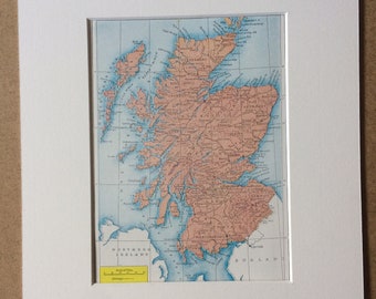
1940s Map of Scotland Original Vintage Print - Scottish Decor - Scottish History - Mounted and Matted - Available Framed
$60.40
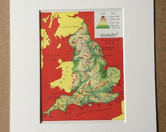
1940s England Physical Map Original Vintage Print - Mounted and Matted - Showing Mountain Ranges, Hill Systems, Rivers - Available Framed
$31.61
1898 Ecclesiastical Divisions of England and Wales Large Original Antique Ordnance Survey Map - Cartography - Gift Idea
$35.12
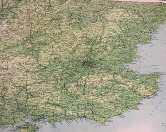
1898 Southeast England (Geographical Features) Large Original Antique Ordnance Survey Map - England - Cartography - Gift Idea
$35.12
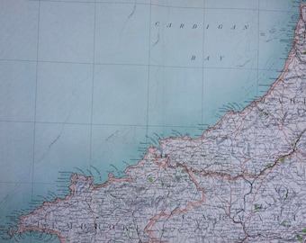
1898 Cardigan Large Original Antique Ordnance Survey Map - City Plan - England - Britain - Cartography - Gift Idea - Local History
$35.12
1898 Canterbury Large Original Antique Ordnance Survey Map - City Plan - England - Britain - Cartography - Gift Idea - Local History
$35.12
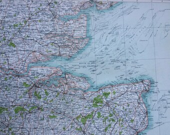
1898 Dover Large Original Antique Ordnance Survey Map - City Plan - England - Britain - Cartography - Gift Idea - Local History
$35.12
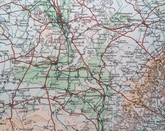
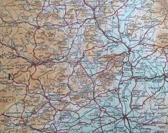
1922 Monmouthshire, Gloucestershire, Oxfordshire Original Antique Panorama Map - Ordnance Survey
$37.93
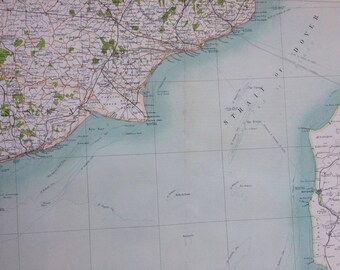
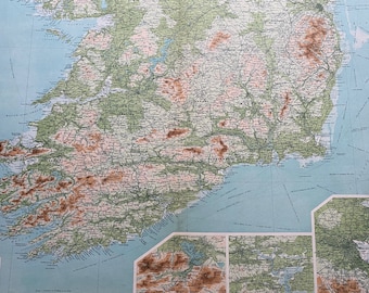
1922 IRELAND (Southern Section) Large Original Antique Times Atlas Physical Map with inset maps of Dublin, Cork and Killarney
$39.33
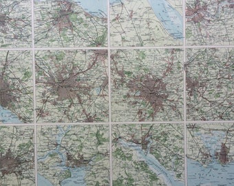
1922 Towns of England and Scotland Large Original Antique Times Atlas Map - Manchester, Birmingham, Edinburgh, Southampton, Bradford, Hull
$39.33
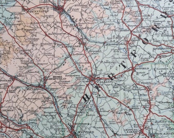
1922 Essex, Hertfordshire, London, Middlesex Original Antique Panorama Map - Ordnance Survey
$37.93
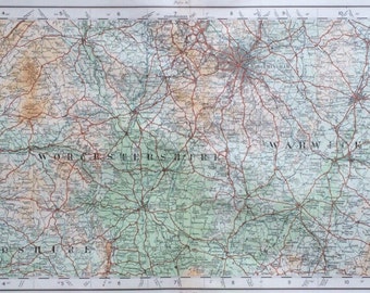
1922 Worcestershire, Herefordshire, Warwickshire Original Antique Panorama Map - Ordnance Survey
$37.93
1922 Worcestershire, Warwickshire, Herefordshire Original Antique Panorama Map - Ordnance Survey
$37.93
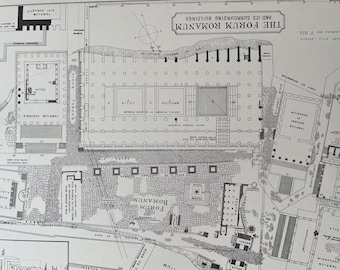
1875 The Forum Romanum and its surrounding Buildings Original Antique Map - Rome - Roman History
$35.12
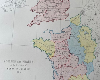
1875 England and France at the Accession of Henry the Second 1154 Original Antique Map - History Map - Available Matted and Framed
$34.41
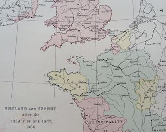
1875 England & France after the treaty of Bretigny 1360 Original Antique Map - Available Matted and Framed - Brittany - French History
$26.69
1
2
3
4
0 items in your cart
Close
Keep shopping! :)
Legal imprint
Close